No. 31 沱沱河 - 格尔木#
编号 (No): 31
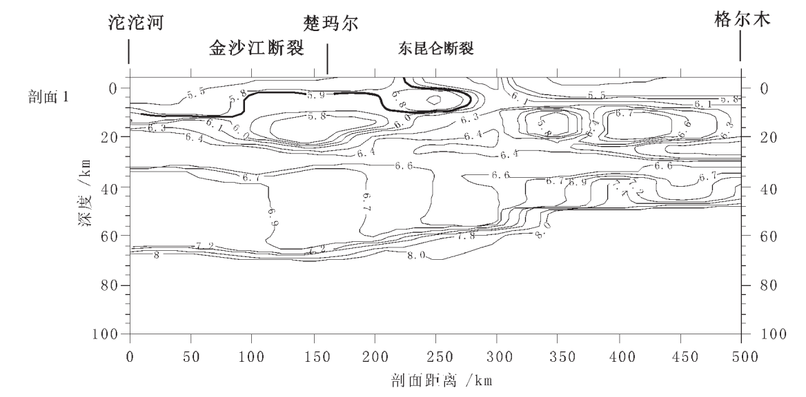
剖面名称 (Name): 沱沱河 - 格尔木
年份 (Year): 1983
长度 (km): 340.0
起点坐标 (Start Coordinates): 92.44474, 34.217731
终点坐标 (End Coordinates): 94.89, 36.42
炮数 (Shot Number): 未知
装药量 (kg): 未知
间距 (km): 未知
参考文献 (References): 卢德源和陈纪平,1987;卢德源和王香泾,1990;李秋生等,2003
Li, Qiu-Sheng, Su-Ping Peng, Rui Gao, and Jing-Yi Fan. “Seismic Evidence of the Basement Uplift in the Bayan Har Tectonic Belt Qinghai, and Its Tectonic Significance.” Geological Bulletin of China 22, no. 10 (2003): 782–88.
Lu, De-Yuan, and Ji-Ping Chen. “Deep Crustal Structure in the Tuotuo River-Golmud Region in the Northern Part of the Qinghai-Xizang (Tibet) Plateau.” Geological Review 33, no. 2 (1987): 122–28.
Lu, De-Yuan, and Xiang-Jing Wang. “The Crustal Structure an Deep Internal Processes in the Tuotuohe-Golmud Area of the North Qinghai-Xizang Plateau.” Bulletin of the Chinese Academy of Geological Science 21 (1990): 227–37.
李秋生, 彭苏萍, 高锐, 范景义. 青海巴颜喀拉构造带基底隆升的地震学证据及其构造意义[J]. 地质通报, 2003, 22(10): 782-788.
卢德源, 陈纪平. 青藏高原北部沱沱河—格尔木地区地壳深部结构[J]. 地质论评, 1987, 33(2): 122-128.
卢德源, 王香径. 青藏高原北部沱沱河—格尔木地区的地壳结构和深部作用过程[J]. 中国地质科学院院报, 1990, (21): 227-237.